Monday, May 14, 2012

Wrightsville NC to the Chesapeake - April 2012

A cold front came through on the way to Wrightsville Beach, so I arrived with a little bit of wind to approach the dock at the marina. And, the weekend was a little cool for the beach, but still nice.  Kim and Katherine arrived Thursday afternoon after I had made a trip to the West Marine.  We had a nice visit for the weekend.  We went to see the Hunger Games at a theater in Wilmington, had a nice day walking on the beach, and went to Easter Service on Sunday.  Katherine headed back to Raleigh on Sunday afternoon; Kim and I headed north on the ICW for a planned seven day trip back to White Stone, Va.


Kim and Katherine on Wrightsville Beach

A half day of travel got us to Camp Lejeune for the nights anchorage.  Then another day got us past Oriental NC.  We stopped in Broad Creek - a nice anchorage, once you figure out the entrance.  This is also home to the River Dunes marina and housing development.  Worth a visit on the next trip.  From here, we continued across the Pamlico River, past Belhaven and through the Pungo-Alligator Canal.  We anchored just past the exit of the canal at the base of the Alligator River.  The next morning brought an anticipated cold front - but stronger than expected.  We started up the river, but encountered stronger winds than expected.  30 plus knots directly on the nose made for slow, cold travel.  We decided to turn back to the anchorage and wait for the winds to lay down.  In the early afternoon, we followed other boats up the river, and through the Alligator bridge.  The crossing of the Albemarle Sound started out OK, but turned nasty as we went along.

Bird Gathering - Crossing the Albemarle Sound
Winds were projected to settle down below 20 knots - and they did for a bit.  But later in the afternoon, they picked back up to the mid - 30's.  We discovered why they talk about this shallow sound getting rough in a high wind.  It was like traveling through a washing machine - a confusing wallow of seas that came from the front, or from either side, with no particular pattern.  This lasted for the whole crossing.  This was absolutely the coldest week of the entire trip. Adding to the fun, the chart plotter decided to go haywire today.  While it was working, it was reading in reverse - the boat icon was facing stern first, and the course was heading down the screen rather than up.  This added an interesting navigational challenge. We made it across the Albemarle and anchored in another Broad Creek, just on the northern side.


Broad Creek - North of the Albemarle

From here, we stopped at Coinjock for fuel, and made it to Great Bridge that afternoon.  We spent the night at the Atlantic Yacht Basin, and passed through the lock the next morning.

Kim - in the lock - Great Bridge, Va
After the lock, the morning was spend navigating the bridges through Norfolk, and following the river out into the Bay.  We were treated to a rare sight leaving Norfolk - a returning submarine with a Coast Guard escort.  When we got into the Chesapeake that afternoon, it was a pleasant motor sail north.  We arrived back on Indian Creek that evening and entered the slip at 8:00 - just as the last light was fading.  Back home on April 14 - about a 5 month trip.  Now for the next one....

Back home - Pitmans Cove off of Indian Creek


Charleston SC and North - March 2012

After Mom's funeral, Kim dropped me back off in Hilton Head, and met me the following weekend in Charleston.  It was a two day trip, and was uneventful, so I got there early and got settled into the City Marina for the weekend.  North of Beaufort, I was treated to fly overs of Navy jets doing touch and go landings. Not sure the picture does it justice, but here is one shot I got of a passing jet.

Boats and Planes - north of Beaufort

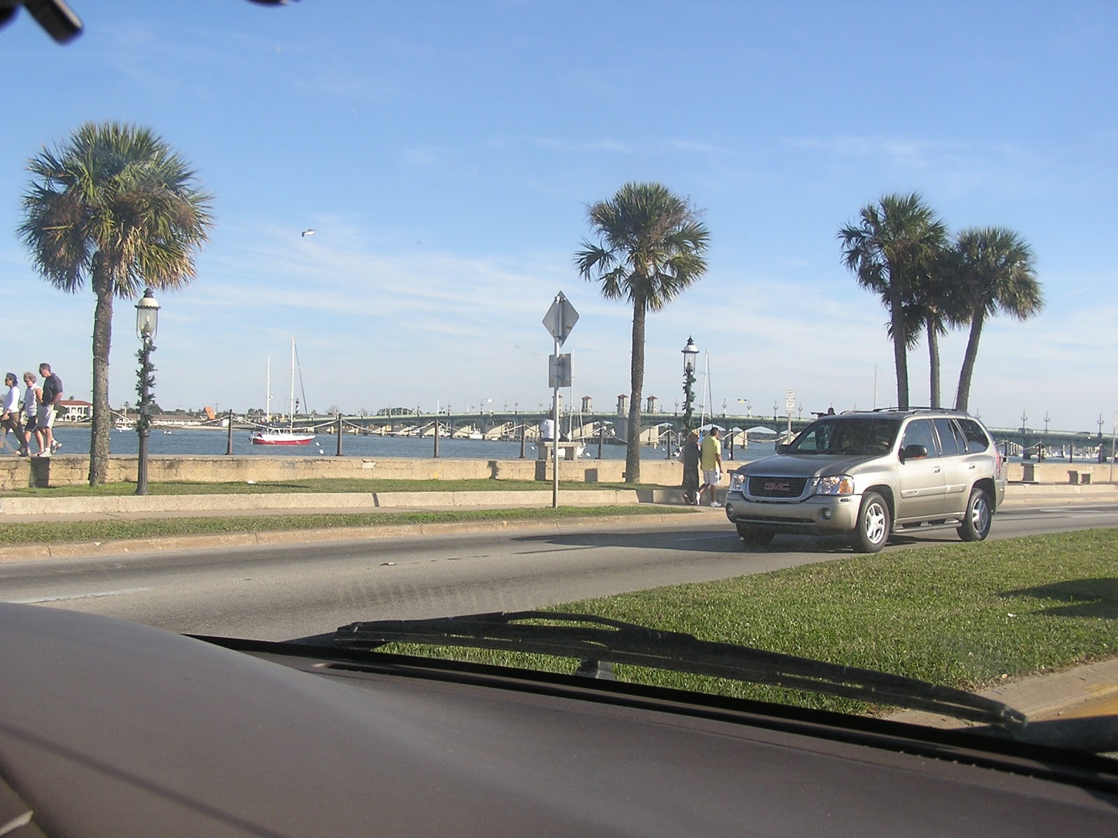
Charleston is one of my favorite cities - it's just a lot of fun to walk around in, and has some great restaurants. We were in town for the annual Cooper River Bridge Run - a 10K run and walk.  Kim and I were walking it, while our daughter and her boyfriend, and several others were running the race. My sister, Pam joined us for the weekend.


Cooper River Bridge - from downtown Charleston

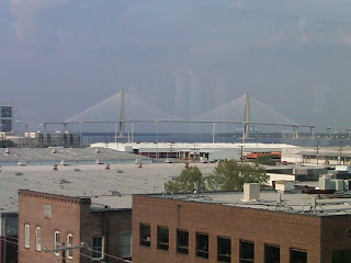
Top of the Bridge - halfway point

It was a great weekend. We got together for a good seafood dinner at Shem Creek, did the race (we all survived), and then just chilled out after the race. The race had record attendance - 14,000 souls.  It kind of overwhelmed the race organization, so the start was delayed (Kim and I left the start for coffee and donuts - and still got back before our corral got going) and provisions ran out (water stations with no water) - but overall, still a good event

After everyone headed home, I left the following morning heading up the ICW to Wrightsville Beach.  It was a four day trip, with more than it's share of adventure.  The first day after leaving Charleston got me to an anchorage just south of Georgetown.  It was in Winyah Bay, just after coming through the land cut. I lived to regret this one.  The anchorage was not sheltered, but winds were not in the forecast. It took a couple of tries to set the plow anchor (or what I thought was set).  Shortly before dark, the winds picked up, and the boat began dragging.  It became a routine of lifting the anchor, motoring up and resetting.  The problem was the wind was strong enough that I couldn't get slack in the rode long enough to completely raise the anchor (since I was single handing).  Finally, it looked like I was holding, but just for good measure I threw in a second anchor (brand new Fortress) and retired for the night.  Early the next morning, I awoke to a loud pop and went on deck to see that I had drug a good way across the waterway.  The pop was the anchor rode for the Fortress - it looked like it shredded on a sharp object and separated - goodbye anchor.  When I raised the main anchor to get underway, I saw the  source of my original anchoring problems.  The plow had a cinder block hanging from each side, with a nylon line holding them together.  The only way to free it was to hang off the bow with a knife to cut the nylon line - fun.  After I freed the anchor, I was underway again - a little wiser about anchorage selection.

The morning trip was a nice motor up the Waccamaw River.  The river water is the color of dark tea, but the river is wide and deep, and very scenic - with Cypress trees lining the bank. From there, it was into the landcut passing Myrtle Beach.  Anchorage for the evening was a nice little river just south of the NC line at Little River SC.      

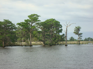
Waccamaw River - north of Georgetown
The next day had me passing through Southport NC and up the Cape Fear river to Carolina Beach for the night.  Southport marked the completion of a large circle, since this is where we originally headed offshore on the trip down.  This leg also had the next bit of adventure.  Just after passing through Snow's Cut into Carolina Beach, I passed a barge heading into the cut.  Snow's cut is very narrow with a strong current - so it a challenge to navigate normally.  As I headed into Carolina beach to find an anchorage, I listened on Channel 16 to the barge captain.  He was heading into the cut with the current and encountered a small fishing boat (that apparently wasn't visible to him).  Following directions from other boats in the cut (who were trying to stay out of the way), the barge was trying to back down against the current to avoid swamping the small boat.  It was a bit of high drama for about 5 minutes - and I'm sure it was stressful for the other boats in the cut. But - everyone came thru OK.

I headed into Wrightsville Beach the next morning....


Hilton Head Island, SC - March 2012

It was another two days on to Hilton Head.  Since the goal was to meet family in Charleston for the Cooper River Bridge Run, I had extra time on my hands.  The plan was to spend a week hanging out in Hilton Head and doing projects on the boat.  Unfortunately, I got the news that my mother had passed away.  She was a lovely, gentle lady, and at 92, had a good full life.  I ended up leaving the boat in Hilton Head to return home for the funeral.

The second day out from St Simons, I awoke to a chart plotter that did not want to work.  So, this was a day of reverting back to paper charts and visual navigation.  Guess we all need to do this once in a while to keep up the skills.  That evening, before I got into Hilton Head, I was anchored just to the south in the bend of a river at the southern end of Daufuskie Island. A line of thunderstorms came through, with pretty dramatic lightning - a hard thing to capture in a picture,but I got at least one shot.  


Thunderhead - Daufuskie Island SC

When I got to Hilton Head the next day, I went to the top of Broad Creek and anchored off of Shelter Cove.  This gave me a couple of days to visit the island, trouble shoot the chart plotter and water heater (no hot water) and have dinner with friends, before heading back to Charlotte. The anchorage off of Shelter Cove was a good one - 10 feet of water, and no one else around.

Shelter Cove - at Hilton Head Island

The afternoon was spent touring the island on a rented bicycle (and visiting West Marine). Later, I met friends from Charlotte at their place in Palmetto Dunes.  We went for a little light refreshment and seaside entertainment - which turned out to be a very nice combo.  They played a good mix of classic and contemporary music - and one of the guys could really hit the high notes.

Entertainment - Palmetto Dunes - Hilton Head SC

The chart plotter turned out to be a blown fuse.  The water heater was a kinked hose.  Pretty quick repairs. After a last night at anchorage, I left the boat at Palmetto Bay marina, went back to Palmetto Dunes for dinner (nice friends), and left the next day for Charlotte (driven by the same friends - now you can't beat that).  Here's a shot of the last night at anchorage....

Sunset - Shelter Cove


St Simon's Island, Ga - March 2012


Well, it took about a month for the repair work on Dreamer to be completed in St Augustine.  A lot of fiberglass work to the rudder, and the aft section of the hull.  The good news is that it should be a lot stronger than it came from the factory.  I left Charlotte in early March for St Augustine.  It turned out that the best way to get there was by Greyhound bus - haven't traveled that way in quite a while. St Augustine is a beautiful city - will have to stop again....

St Augustine Municipal Building

I left St Augustine for a leisurely trip up the ICW, with a few planned stops along the way. The first leg was to St Simons Island, Ga.  This was a two day trip.  I stopped by to check out St Mary's Ga on the way.  I had heard from several cruisers that this was a favorite place to leave their boats for extended storage.  It was a nice little town on the river, and a good possibility for long term storage. The two day trip was uneventful, except for picking up a crab pot at the entrance to St Mary's River. At least that's what I believe it was.  The helm was sluggish (like a weight hanging on the propeller shaft), and my first thought was that something had gone wrong with the recent repair.  Thankfully, by the time I stopped, had lunch and thought about it (climbing down to check things out and cut it free if necessary), it had worked itself free and the helm was back to normal. Thank goodness.  I spent one afternoon and night at St Simons - long enough to walk around the island.  This is one of the stops that it would have been good to have a bicycle on board.  But, it was a nice walk, and served to get me ready for the 10K walk soon to come in Charleston. 

From the pier at the end of the "town strip", I got a good picture of the St Simon's lighthouse,...

St Simons Lighthouse


And a very photo friendly pelican.....
St Simons Pelican

Saturday, January 28, 2012

Back to the States - January 2012


Well, it’s almost the end of January.  I’m writing this from St Augustine, Florida.  After leaving the Exumas Land and Sea Park, we got into travel mode for our passage back to the States.  The weather outlook was favorable for a return passage, so we were shooting to take advantage of it while it was there.  We did a day trip to Highbourne Cay, where we refueled and got water, plus a little internet time.  Pat got in her last opportunity for snorkeling. The next day we left early, headed for Nassau.  We made good time, and arrived in Nassau, after passing across the Yellow Banks (a known area for coral heads to avoid).  We had good tides and good visibility (sun overhead), and made it through OK – only had to dodge a few.  We got into Nassau at 3:00 and anchored in Nassau Harbor, across from the Atlantis Resort.  Since we were in travel mode, we didn’t stop to go ashore.  We ended up bumping another boat at anchor about 3:30 in the morning (a French Canadian with 100 ft of chain out).  So, we decided to pull anchor and leave at 4:00A for our next destination.  We left Nassau in the dark (nice deep channel), and passed all the cruise ships waiting in line to come in the next morning.  Our destination was the Berry Islands.  We ended up stopping just on the other side of Little Stirrup Cay.  Little Stirrup is an island owned by the cruise lines, that they have developed into an island playground for their customers.  A cruise ship was docked when we arrived, so we went around to find an anchorage for the night.  The next morning we were on the move again with a 6:00A start for Lucaya on Grand Bahama Island.  We made excellent time (under motor and sail), and also got a chance to learn more about the capabilities of the radar to track other vessels we passed (big ships).  We made it into Lucaya around 2:00P and went into a marina.  We stayed for two nights, and got to see a little bit of the island by motor scooter, and by walking.  Lucaya is home to the Grand Lucayan beach resort – a very nice upscale facility.  While on motor scooters, we stopped for lunch at a lovely nature preserve.  From Lucaya, we left for our crossing back to the states on Thursday morning the 26th.  Our plan was to round the southern part of Grand Bahama Island, and set a course to St Augustine, taking advantage of the Gulf Stream as we headed north.  The forecast called for 15 knot winds from the East / Southeast for the next two days, with a cold front coming through late Friday that would shift winds to the North (not good for a gulf stream crossing).  Our weather window allowed for an overnight sail to reach St Augustine before the front arrived (about 30 hours).  We left at 6:30A in light showers, and set our course for St Augustine.  Off of West End, we stopped to assist a couple of men in a 20 foot power boat that had run out of fuel.  We responded to their Mayday call. Seems they had left the Florida coast bound for Bimini, and had been carried north by the gulf stream to West End on Grand Bahama.  They had no spare fuel and no working GPS, and actually thought they were off the coast of Bimini.  We gave them what gas we had on board and contacted local help to assist them, then continued our trip. The night sail was good, with 15-20 knot winds that were more from the South than the Southeast. By the time morning came, winds had increased and began to clock more from the West, and eventually due North – the front had arrived early.  We battled 30 plus knot winds dead on our nose, and choppy seas, through the morning.  The wind and seas began to subside around 1:00 as we approached St Augustine.  Our information on the inlet said to obtain local knowledge, and not to approach in any chop, so our backup was to head on up to Jacksonville for an entry if we couldn’t make it into St Augustine.  As it turned out, the weather died down and we entered St Augustine without problem.  The inlet was a dramatic one, with surf breaking on either side of you as you came in through a narrow, but well marked channel.  St Augustine itself is a popular boating stop, with a nice old historic section and many nice restaurants.  We settled into the marina, took nice hot showers and went for a very nice dinner at a place by the name of Raintree. The city, and the restaurant, are definitely worth another visit someday. Now that we're back, its time to go home for a visit.         

Anchored in Nassau Harbor

Dawn - after leaving Nassau
  
Entering Lucaya
Heron in the nature garden 

Local Parrot

Marina in St Augustine
St Augustine Waterfront

Camachee Island Marina

Flagler College building


Thursday, January 19, 2012

Traveling North from Georgetown - January 2012


On Wednesday, January 11 we topped off with fuel and water in Georgetown, and started north up the Exuma chain. Our schedule called for being in the Abacos, at West End by February 1 for a crossing back to the states.  We left Georgetown, bound for Galliot Cut, with a schedule of stops to make on the way north.  Our actual destination ended up being Cave Cay, where we stopped for the night in the company of a French charter boat that had party music and lights going into the night. From there, we moved further north, picking out good snorkeling spots.  We saw three eagle rays in formation on the north side of Galliot Cay, along with a huge turtle.  We moved up to Little Farmers Cay, where we helped a local lady clean lobster heads, and bought some very nice (huge) lobster tails for eating later. Our next stop was Staniel Cay, where we snorkeled Thunderball Cave (of James Bond fame), had some good cracked conch, and rejoined some friends from the Abacos who were in the same anchorage.  After that, we headed to Sampson Cay to wait out a front that was forecast to be coming through.  The front didn’t come as strong as forecast, so we headed on to the Pipe Creek area.  The wind was blowing 25- 30 knots when we got out, so we motored around to Pipe Creek, and anchored for the night.  Pipe Creek was beautiful – lots of shallow water, with beautiful colors and islands dotted all around. Very much worth a stop – a place I would like to return to. From there, we headed on to the Warderick Wells area.  After motoring through a challenging cut, we enjoyed a sail in 20 knots winds, coming into the back side of Warderick Wells. The following morning we went around to the front side of the park by the ranger station.  This is the heart of the Exumas Land and Sea Park, a protected area for both land and sea creatures.  The anchorage in front of the Park HQ is one of the most picturesque areas I have seen.  We enjoyed a walk up to Boo Boo Hill, where cruisers leave remembrances of their boat, and there are scenic views of the area.  We got to visit local blow holes (no water, but strong gusts of wind.  For dinner we had some of the lobster tails purchased earlier – most excellent. Our plans from here are to work our way north to Highbourne Cay, and leave from there for Nassau, then to Bimini, and then to West End to wait for a crossing to the states.      

"Downtown" - Little Farmers Cay

Sunset - Cave Cay

Party Boat - Cave Cay

The airstrip on Little Farmers Cay

Local Inhabitant - Pipe Creek

Private Boat Harbor - Pipe Creek

Little Pipe Cay Resort

Touring by Dinghy - Pipe Creek

Stone trail markers - Warderick Wells

Anchorage at Warderick Wells

Hilltop view of Warderick Wells anchorage

Pat meets the blowhole

Pat & Bill on Boo Boo Hill

Tuesday, January 10, 2012

Georgetown, Exumas - January 2012


We left at 7:30 the next morning to make it through the cut before the tide built up the waves too much (they tend to get choppy as the tidal current builds).  We were in the company of two trawlers and a couple of sailboats.  The trawlers were with us until we reached Georgetown – and they were having much better luck fishing than we were.  We arrived in Georgetown just before 2:00P and anchored at Stocking Island, just in time for afternoon volleyball. Stocking Island is a picture perfect location, with plenty of organized activities to keep you busy.  We visited for a couple of days, with Pat & Walt catching up with old friends. We attended beach church on Sunday - a unique experience - we actually had a trio of violins playing. We got in plenty of volleyball and beach walking, and visited Georgetown for groceries and laundry. Pat and I had a nice walk around the island .yesterday while Walt played volleyball. We had cocktails with boating friends, and a good dinner afterwards - steaks for a change of pace.   As I make this post, it is Tuesday Jan 10. Pat and Walt are playing Tuesday night Texas Holdum at the St Francis while I do a little computer time.  Our plans are to top off with fuel and water tomorrow, then start to head north on Wednesday for our return to the states in mid-February. Seems like it’s too soon, but we have to stick to schedule to get back in time.  We'll see how internet access is along the way - will update as I get the chance.

Margaritaville

Leaving Galliott Cut

Volleyball Beach 

Stocking Island Sunset

Beach Church

Beach Church Choir

View from St Francis Hotel

Stocking Island Anchorage

Monday, January 9, 2012

Staniel Cay, Exumas - January 2012


Gypsea Heart left for an overnight sail to Conception Cay, while we continued south.  We left though a cut heading for the Exuma Banks (as opposed to Exuma Sound). The cut was narrow, and the light not the best.  We ran aground on a sandy bottom, but got off with an assist from the sails and the dinghy. That afternoon we got to Big Majors Spot and anchored for the night.  In the morning, we fed the pigs that hang out on shore (they enjoyed a feast of old brussel sprouts). We visited Fowl Cay, home of a sandals resort, and then took the dinghy to Staniel Cay for lunch.  It was a bid chilly for snorkeling, so we passed on Thunderball cave – will save that for another visit. The rest of the day was a motorsail south to Big Farmers Cay.  We got in with only about 20 minutes of daylight left, and anchored behind Galliott Cay for an early departure the next morning through Galliott Cut into Exuma Sound.  We were only one island away from Musha Cay (owned by David Copperfield, with its own resort).  This area was just a beautiful, isolated anchorage.


A Staniel Cay Pig


Feeding Time

Fowl Cay Beach
 
Anchorage at Big Major Spot


Fowl Cay

Fowl Cay